June 28, 2000
14,411 feet
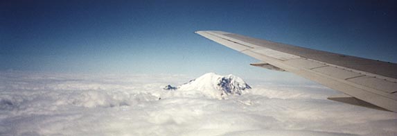 Mount Rainier as seen from our flight as we descended into Seattle |
|
Mount Rainier is widely known as one of the most difficult endurance climbs in the lower 48 states. I can state that even though I thought I trained fairly well, I struggled to make it through the entire climb. Over a 30 hour period, approximately 21 of those hours were spent climbing or descending the mountain. The altitude gain was over 9,000 feet and, of course, the descent covered over 9,000 feet as well. I used Rainier Mountaineering (RMI) as guides for this climb. I was joined by my friend, Jon White. Jon and I were on Rainier a couple days early so we had already been up part of the mountain to Panarama Point. We had discovered that the animals in this park seem to have no fear of people. Deer graze by the roadside and ignore passing cars. Marmots scurry around the trail, ignoring hikers that are walking by them. |
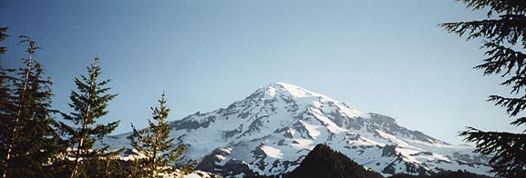 Rainier as seen from the campgrounds below the mountain |
|
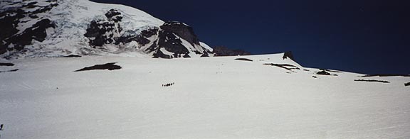
The climb began around 10am. We were hiking in a single-file group up the trail from Paradise onto the Muir Snowfield. It seemed to take much longer to get to certain landmarks than you would think even though they appeared to be quite close. The scale of this mountain is deceiving- it is actually much larger than it looks. |
|
|
|
After about 5 hours of hiking we rolled into Camp Muir, our resting place of a few hours. We were given some time to rearrange our backpacks for the upper mountain and we were given some hot water to make dinner (dehydrated chicken and rice for me). We were stacked side-by-side on shelves for the opportunity to rest for 4.5 hours. Because it was so noisy and crowded, I didn't sleep any. Some did, because I could hear them snoring. |
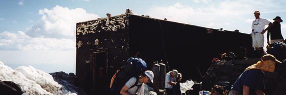 Luxurious accomodations for 20+ people! |
|
At midnight we got up, made a quick breakfast with some more hot water (oatmeal) and got dressed for the climb. It was a cold, clear night with a crescent moon. My rope team was a good one- John from Montana, Andre, and our guide, Adam. We roped up at Muir and didn't unrope until we reached the summit. Our climb began by crossing the Cowlitz Glacier. We followed the path across the glacier to a rock formation called Cathedral Rocks. We crossed a rocky gap in that formation called Cathedral Gap, which was unpleasant as we moved across the loose scree while wearing our crampons. The scratching and screatching sounds of metal tips on rocks weren't enjoyable and the footing wasn't very good. Once on the snow again, we were on the Ingraham Glacier. Since it was still early in the climbing season on Rainier, we took the Ingraham Glacier route, a more direct route than the most widely used Disappointment Clever route, which is used later in the season. Once on the Ingraham Glacier, we moved up between Gibraltar Rock and Disappointment Clever and then up to the summit, which is the rim of the volcano. On the Ingraham Glacier, we crossed one ladder over a crevasse and stepped over a couple of other crevasses. They were very deep. The contrasting temperatures causing me some problems. I would warm up from hiking so I would remove some clothes. Then we would come over a ridge and the wind would be very strong and cool me off. At one point, I lost feeling in my hands and had to make our rope team stop for me to put some shell mitts over my gloves. Our breaks were few and brief, but an insulated jacket was necessary immediately because of the cold. Most of my food was too hard to eat (granola bars and protein bars were rock-hard), so I got by mostly on animal crackers and raisins. The altitude wasn't as much of a factor as I thought it would be until the last 45 minutes or so when I really began to lose power. We were ascending a slope that was around 60 degrees in angle (using switchbacks to ease the ascent). By the summit, I didn't feel real well from over-exertion. I just sat on my pack for a while on the top, doing nothing. The summit was cold and windy- even though I was wearing all of my clothes, I began to get very cold after sitting on top for about 30 minutes. |
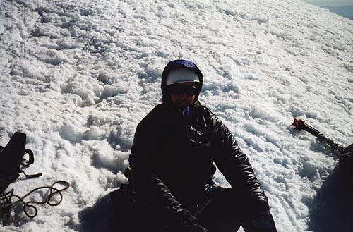 Resting just below the summit. I needed all of my layers up here. 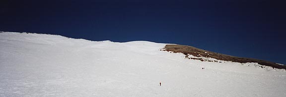 The view of the summit crater. The small speck in the center is Jon. |
|
Having spent most of my energy to get to the top, I had doubts as to how I could get back down the mountain. After a short hike down from the summit, we stopped so that everyone could take off most of their clothing layers. It was now full daylight and we were all getting quite warm. It was very interesting to see some of the crevasses that we had passed and not seen as well when it was darker. |
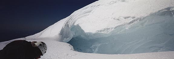 One of the crevasses we passed on the climb. |
|
The RMI guides made a point of going very fast down the mountain. The later in the day we were on the upper mountain, the higher the risk of avalanche or rock fall injuries. On the Ingraham Glacier, in a particularly dangerous area, we saw where an avalanche had covered our trail since we had gone over it this morning! The rope teams went one-at-a-time through this area while the others watched and yelled "Rock!" if an boulders started bouncing down the mountain at us. It was hard to move quickly through this area because the snow was deep and we kept tripping as we pulled each other down the trail. At the end of the danger area for rock fall, we crossed a snow bridge. I managed to poke a leg through, which added a little excitement to the hike. The rest of the descent was a tedius and long ice slog. After retrieving the rest of our gear at Camp Muir, we continued down the rest of the mountain to Paradise. Needless to say, I was dead. I'm glad I got this highpoint, but I can't say I'll come back to do it again any time soon! |
[ Back to the Highpoints page ]
